A team led by NASA scientists is showing how a fixed-winged drone named Vanilla could fly for several days over the Arctic ocean carrying an instrument that uses radar to measure the depth of snow accumulating on top of sea ice.
Follow Air Recognition on Google News at this link
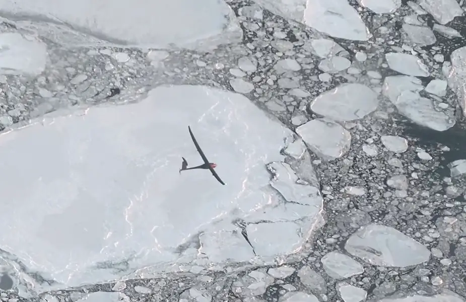 Vanilla flying over sea ice off Alaska’s North Slope in November 2021 (Picture source: Platform Aerospace)
By testing the drone and snow radar instrument together, the team wants to provide key data to more accurately track and project how Earth’s polar regions are changing and influencing sea level.
Because snowfall puts an additional layer of snow over sea ice, even some of NASA’s most powerful altimeter systems in space struggle to measure the thickness of the ice. Data from drones flying at low altitudes can help scientists measure this changing thickness more accurately as Arctic sea ice waxes and wanes with the seasons.
“The same technique could eventually be used to assess how freshwater melting from Greenland and Antarctica contributes to sea level rise,” says Brooke Medley, a research scientist at NASA’s Goddard Space Flight Center in Greenbelt, Maryland, who leads the project.
In other words, Medley sees in drones, a path toward increasingly accurate projections of how sea level rise might reshape coastlines worldwide, and, for more temperate climates, a promising new tool to monitor wildfires, algal blooms, and other vital signals of change on Earth.
In November 2021, Vanilla flew for six hours over open ocean and sea ice more than 130 miles (222 km) from an airport in Deadhorse, Alaska, where a pilot controlled the aircraft and a scientist controlled the radar instrument.
By flying in more temperate weather for eight days straight in 2021, Vanilla earned the world record for continuous flight without refueling by a remotely piloted aircraft with internal combustion engine. In Alaska, unusual precipitation prevented multi-day flights, but early assessments show Vanilla could fly for nearly five days over Arctic sea ice.
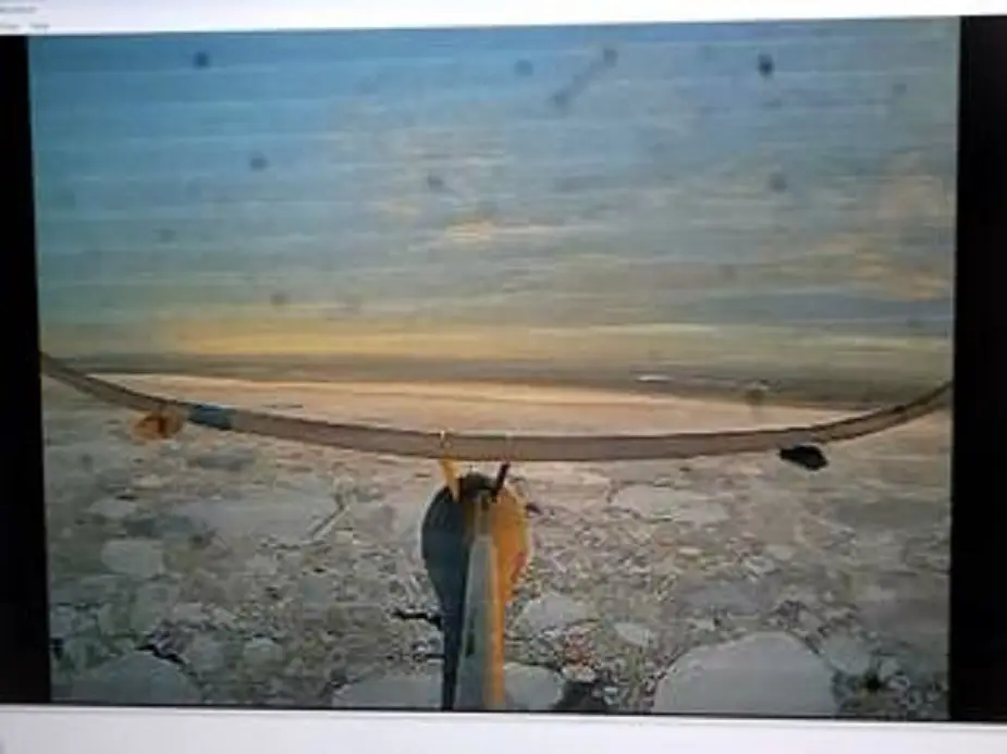 A camera on Vanilla’s tail shows the view over sea ice. Snow efficiently insulates heat loss from the ocean to the much colder atmosphere, and can be used to monitor precipitation. But this accumulated snow also makes it hard for satellites to measure sea ice thickness accurately. (Picture source: NASA’s Goddard Space Flight Center)
To earn its “Arctic wings,” Vanilla flew with ice-detecting sensors, heating systems, and a special anti-icing coating to protect against fog and moisture that can quickly ice on its wings and propeller. The aircraft also runs on a diesel engine, which helps to regulate heat unlike battery-operated drones.
“Drones have come a long way, enough that they can start to be more than just quadcopters flying locally and looking at your neighborhood,” Medley says. “Flying drones is ultimately more green and safer than flying large planes, so this checks a lot of boxes.”
Medley, who leads the project, wants to survey sea ice in the Arctic and Southern Ocean with the drone. Ultimately, the idea is to fly over Greenland and Antarctica, Earth’s two ice sheets. Unlike expensive and labor-intensive airborne campaigns that rely on airplanes and crew, multiple drones could fly simultaneously, on a regular basis, and in multi-day surveys of an entire ice sheet, Medley says.
NASA satellites have played a key role in detecting how ice sheets have lost mass in recent decades. But they have struggled to measure fine details about how variations in snow depth on the surface of the ice affect the thickness of these continental glaciers.
Scientists typically determine the health of an ice sheet by measuring changes in surface height that help assess whether the ice is thinning or thickening. But snow blows constantly all around an ice sheet and piles on its surface over several years like a multilayer cake that satellites struggle to track.
“We have to make sure the thickness changes we're seeing aren't just a single snowfall event or the lack of a single snowfall event,” Medley says. “Then we can better interpret the changes that we're seeing from space if we know how much snow is falling.”
Because sea ice is already floating on the ocean, sea level does not rise significantly when that ice melts. But snowfall that settles on the ice sheets eventually melts and deposits freshwater into the ocean. Stored as frozen water on the surface of an ice sheet, this snow can also stall an ice sheet’s contribution to sea level rise, Medley says.
How exactly that accumulated snow influences sea levels is a poorly understood processes in studies of sea level rise.
“We need to monitor this snow accumulation,” Medley says, “because small changes can actually end up playing a very large role in sea level change.”